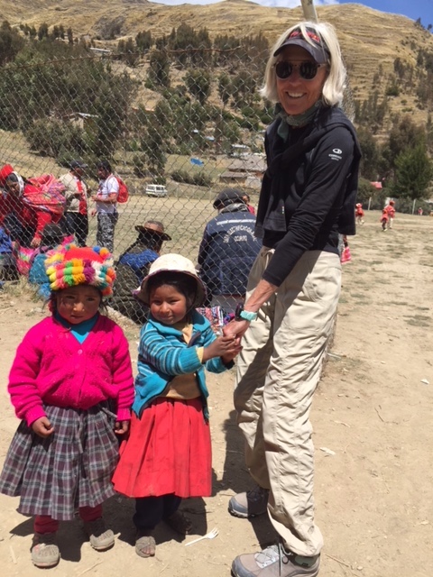
Pat and kids at Patacanchan Village Festival
My older son wrote his college thesis on the concept of “awe:” what did it mean, how was it used, what emotions did it evoke, what was its historical/religious/social context. After many months of research, reading, writing, editing and engaging in discourse with others, he was unable to come to a satisfactory conclusion. The word is overused, inappropriately used, carelessly used, but rarely precisely used. However, during two weeks in the Andes and Amazon River Basin in Peru, I found my definition of “awe” in the immensity, wonder, history, magic and mystique of this unique place: an emotion variously combining dread, veneration, and wonder that is inspired by authority or by the sacred or sublime (Merriam-Webster Dictionary). The area surrounding Cusco, the Sacred Valley, and Machu Picchu was nothing less than awe-inspiring.
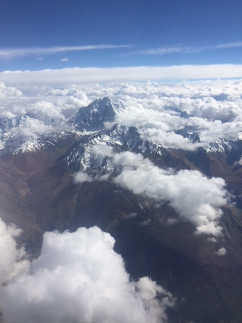
Flying into Cusco, Peru with mountain peaks over 18,000′
Our approach into Cusco portended our fabulous two-week hiking trek in the Peruvian Andes and Amazon River Basin. The airplane flew through light cumulus clouds and bright blue sky, nearly touching 18,000’ snow-capped peaks from the surrounding Andean mountain ranges that would be the lodestar of our journey: the Vilcabamba, the Urubamba, and the Vilcanota Mountain Ranges.
We circled a smaller mountain (still, at 11,200’) on the outskirts of Cusco before landing in the city, brown from late winter, busy with tourists, and lively with local citizens selling food, textiles, and trinkets at the various markets and squares.
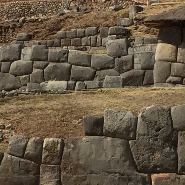
Sample of Inca wall, rocks might take 2000 men 10 years to move into place.
Cusco was the capital of the Inca Kingdom, or “navel,” the center from which the four quartets of the kingdom originated. At the height of the Inca power, its land stretched from Ecuador in the north, to Peru and Bolivia, and along Chile to the tip of South America. Pachacuteq, the Inca-warrior king, rebuilt Cusco in early 15th century, which was later destroyed by the Spanish during their invasion in 1533 and by Manca, the rebel Inca, in 1536. We saw, however, the beginnings of the distinct Inca-architecture, the inclined walls of huge (some at 120 tons) granite stones, placed perfectly in place one next to the other, to form the Cusco palaces for the Inca kings and their extended families. Without tools, other than, archaeologists believe, iron-filled stone, they built mighty, city-block-long palaces for their homes, storage houses for grains (the true measure of an Inca’s wealth was the number of hectares of fertile fields and grains produced), and military installations (for protection).
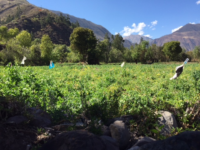
Fertile lands around Cusco still perfect for producing fruits, vegetables and grains.
Cusco also contains the remnants of the House of the Sun, once a temple to the gods, allegedly covered in gold, now the foundation for a Spanish cathedral.
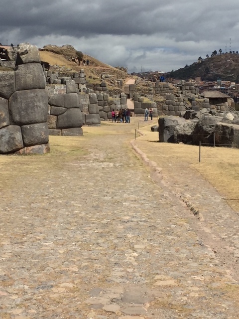
Ruins of Saqsayhuaman, above Cusco.
We visited Saqsayhuaman (at 12,392’), a magnificent Inca fortress overlooking Cusco, huge but lesser known than some of the others. We walked around and upon the three tiers of outer walls of the palace (the higher tiers were destroyed by the Spanish, who didn’t want evidence of potential “pagan” worship after their conquest), with zig-zag formation, maybe to indicate dedication to the Inca’s lightning god. One of the most-inspiring sites, I began to understand the immensity and complexity of the Inca buildings, the size, the ingenuity, the creativity, the workmanship, the enormous manpower (some rocks required 2,000 men over ten years to move from the quarries to the building’s site), the sheer management of a project of several generations’ duration. I was overwhelmed by this fortress, realizing we were only seeing a small part of the original site, and wondered how we still do not understand how these buildings were created. The Incas did not have written plans or drawings, they did not use the wheel to transport the huge rocks, they did not have implements to perfectly set one rock next to or above or beside another one, with no cracks or deviations, which they did, over and over. And then to have this destroyed by the Spanish—shameful!
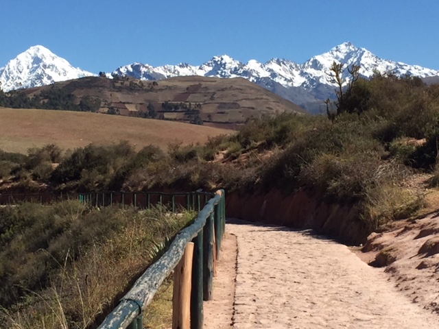
Familiar hiking trails with 360 degree mountain ranges.
We hiked to several “lesser” sites, a rock monolith, carved to take the shape, perhaps, of a puma (cats represented the “present world” of the Inca, while the condor the above-world and the snake the underworld); Tambo Machay, built to incorporate a natural spring; then to the Temple of the Monkeys (so named because a rock has a monkey shape) before hiking part of the Inca Trail (now covered with grass imported from Africa perhaps 100 years ago) back to the colonial part of Cusco (San Blas). The Inca roads once extended 20,000 miles throughout the kingdom, rock roads for transporting the all-important grain products to and from the cities and palaces.
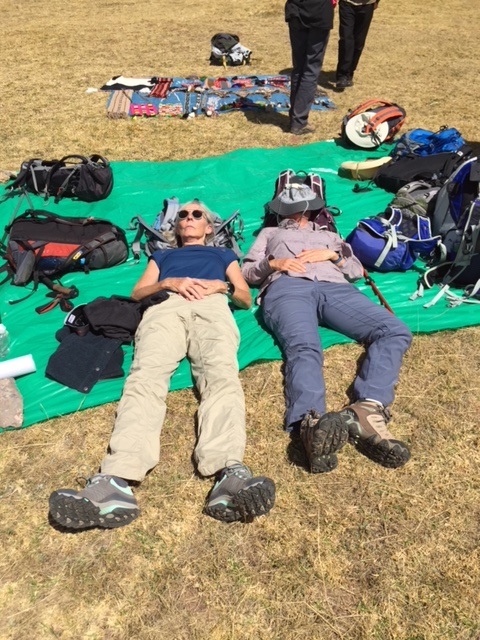
Resting after one of our picnics along the Trail.
The Urumbamba Valley, sacred to the Incas because of the fertile lands and moderate climate, all-important for growing fruits, vegetables and grains (while the Inca conquered 300 or more tribes throughout the empire, they provided food and work and a local language, Quechan, so feeding the population was a huge, ongoing task). In 1968, the Peruvian government privatized all the lands, previously held by a small number of owners, giving small parcels to most citizens. We walked through roads backing small villages, farms with chickens and guinea pig (domesticated in Peru and a staple protein), construction workers drying mud bricks to build adobe houses, abandoned 17th century Spanish chapels, and always, the high, snow-capped mountain ranges in the distance.
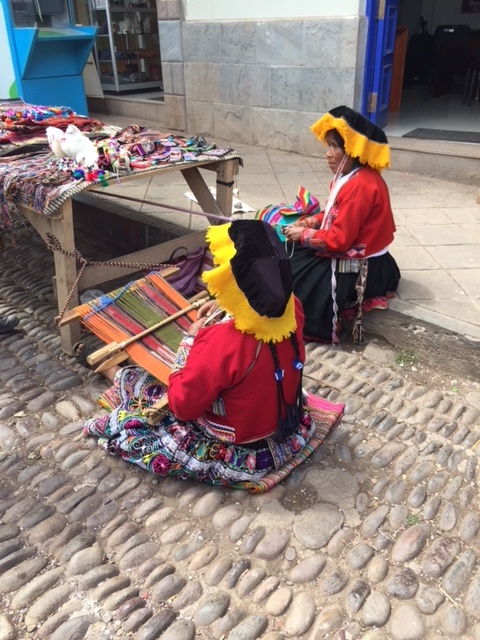
Weavers in Pisac. Clothing is similar to what was worn hundreds of years ago and unique to each tribe.
We visited Chincero, a colonial town built on Inca foundations, unfortunately a common theme throughout this area. Our guide arranged an educational tour of the Chincero Weavers Textiles, an initiative of two sisters who were concerned that the ancient art of weaving techniques was being lost. They started a women’s collective to re-introduce the technique from shearing the alpaca and llama wool, to spinning, cleaning the fleece (using Yucca leaves) combing, dying (using leaves from, e.g., lichen, lupine plant, and cactus), and weaving intricate textile objects. The collective is supported by National Geographic and the Smithsonian, among other non-profit organizations.
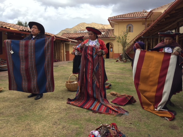
Learning ancient weaving techniques at Chincero Textile cooperative.
In Yucay, a small town in the Sacred Valley, we walked along centuries-old but still actively used, water canals.
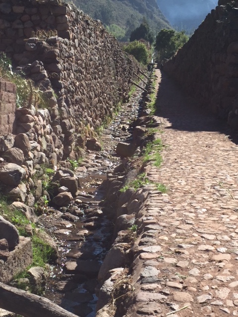
Ancient water canals still in use for farming and irrigation.
Late August is early summer in Peru: avocado, broccoli, potato, pears and apples, and barley were growing. Set high in the cliffs above Yucay were a few Inca cemeteries, where bodies were set into caves (all mummified and often carried from palace to palace before finally put into a final resting place).
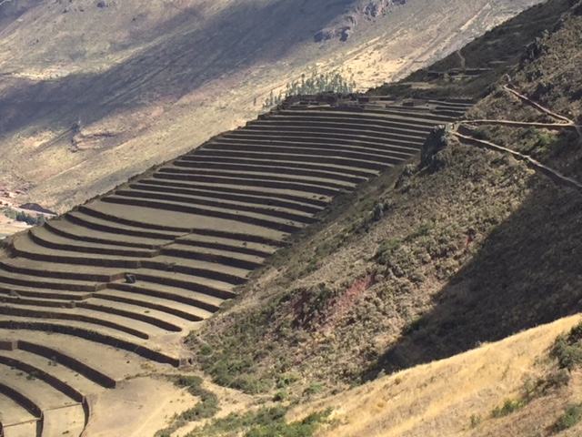
Terraces at Pisac palace.
I was fascinated by the verticality of the Inca terraces, built to provide food (especially corn, potatoes and quinoa) for thousands of people. The engineering ingenuity is unsurpassed. The water management systems are complex. The size and extent of agricultural land owned signified the wealth of the various Inca rulers, were a means of protection, and created beautiful landscapes. (Mother Earth was revered as part of a trinity of the underworld, the present world and the above world.) At Pisac (11,000’) above the Urubamba Valley, these terraces took more than 150 years to complete. Also built high into the cliffside were buildings including a sun temple, the home for the Inca, and, again, military installations for protection. We tried to measure the time of day by the sundial at Pisac (at 10,941’) but with broken spokes, we had to rely on our modern-day watches.
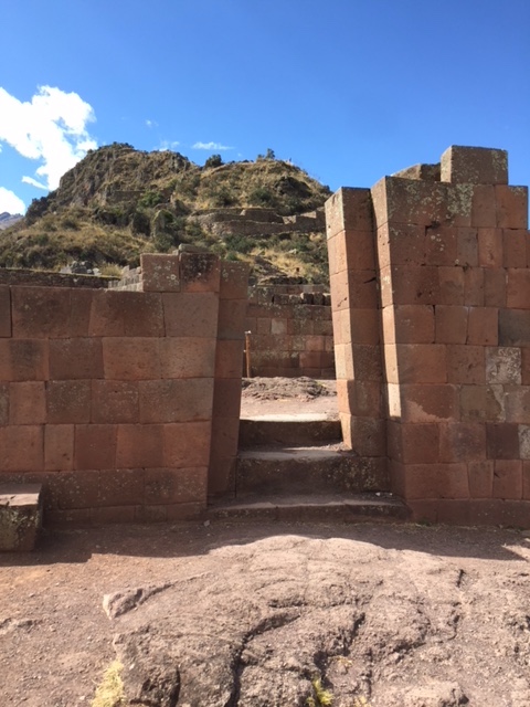
Entry to Sun Temple (and sundial) at Pisac.
There is a concept in Inca-time related to the sundials or other buildings that contained four windows, aligned to capture the sun at winter and summer solstices, and spring and autumn equinoxes, called “sun-rope,” meaning tying the sun to a rope as it disappeared in winter, knowing that one could pull it back with the rope in summer!
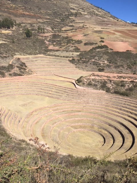
Circular terraces for agricultural experimentation.
The Incas (and it is believed, the Spaniards) experimented with growing different crops and hybrids at altitude. At Moray, concentric terraces were built in natural depressions in the earth to perform these experiments. We learned about the “floating steps,” or large rocks placed about 1 ½’ apart along the terrace walls to allow the workers to more easily climb from one level to another. The Incas displayed an uncanny knowledge of many different fields, engineering, agriculture, weaving, road-building: what would they have discovered if not destroyed by the Spaniard and the conquered tribes disbanded because they had no ruler to follow?
The ancient salt mines of Moray, fed through a stream from deep within the mountains with a salt concentration of almost 65%, are still in use today. The mines were created after the closest salt fields, at Lake Titicaca, became unusable. The nearly 4,000 mines (each a small square of water enclosed by stone and less than a foot deep) are owned by about 1200 local citizens, using a collective to market and sell the salt. A current rage is “pink salt,” created by “harvesting” the salt less than the typical full three days required for evaporation, to retain some of the minerals.
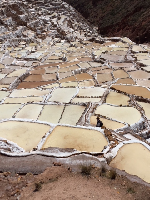
Moray salt mines.
We were entertained by a local brewery that makes “corn beer,” usually an afternoon treat consumed after working in the fields or construction. Our guide was more than willing to show us how it is made and drunk!
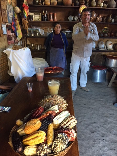
Our guide and the corn beer maker, with ingredients.
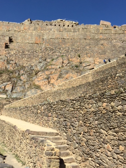
We spent two nights at Ollantaytambo, a living Inca village with original narrow streets, houses built around courtyards, and Inca stonework. The Ollantaytambo ruins are dramatic, especially as the site wasn’t finished before the Spaniards attacked: some of the massive granite stones are left by the wayside, giving us more perspective on the daunting work to bring them up sheer cliffs and steep sloping mountains to create palaces, storage houses, and military installations.
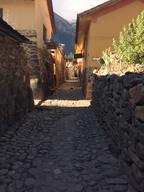
Current day Ollayantampo, not much different than in late 1400s.
Ollayantampo, palace of the last Inca.
A pure treat: we unexpectedly encountered the Patacanchan village (elevation 12,600’) annual anniversary celebration when we drove up to this Andean town for lunch (meat, trout, and veggies cooked in the ground). The families were in festival mode with dances, huge pots of potato soup, politicians campaigning for upcoming elections, corn beer, and Huayan music. Probably not much different than five hundred years ago!
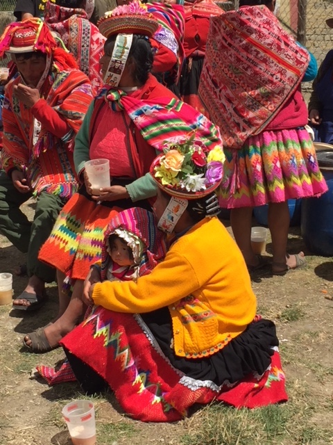
Villagers waiting for start of Patachachan annual festival.
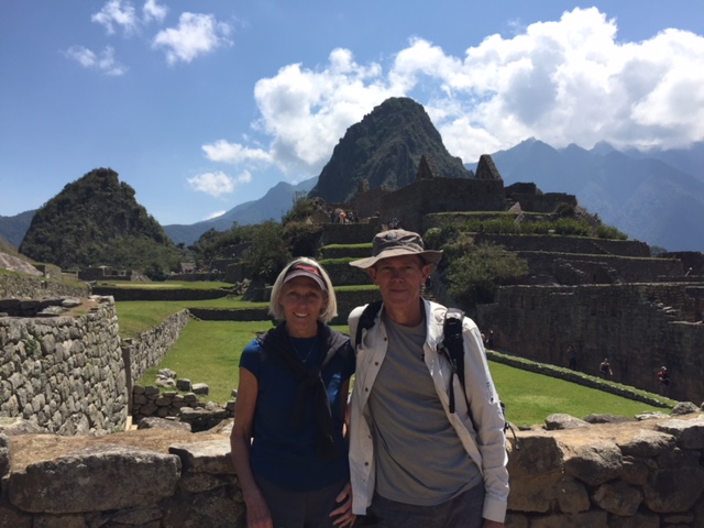
These introductory days, learning and seeing up close the Inca work, the current day economy, the attempts to retain some of the ancient foods and methods of production, made us appreciate the grandeur and splendor and wonderment of Machu Picchu, our ultimate destination, even more special.
Iconic!
We rode the train from Ollantaytambo to Machu Picchu Pueblo (town) then a bus to these most incredible ruins! My mind’s eye will have to retain most of what we saw as photographs do not do justice to this magnificence, although a few pictures may give some color of our journey.

Natural groundskeepers (llama) at Machu Picchu.
We joked about the “postcard” views, which were everywhere; I thought they might take away from the reality of being at Machu Picchu, but the site in person doesn’t compare to what we think it will be. The Inca imagination and then execution of building this massive summer palace is beyond belief.
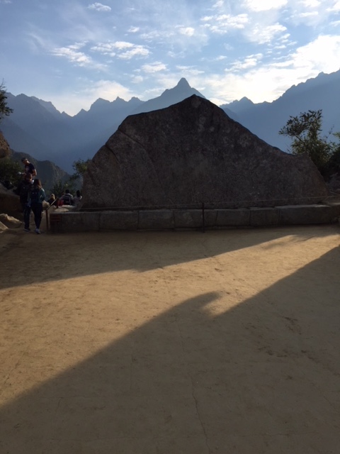
Granite “model” silhouette of mountain range looking east from Machu Picchu.
High on the jungle, reached by trail of stones, then built from granite rocks: sun dial and temple, Condor temple (where mummies were placed before burials), the Inca’s (king) private rooms, storage houses and military installations, all form a huge community of wonder. The five days at other ruins gave us foundation of knowledge to appreciate even more the buildings of Machu Picchu.
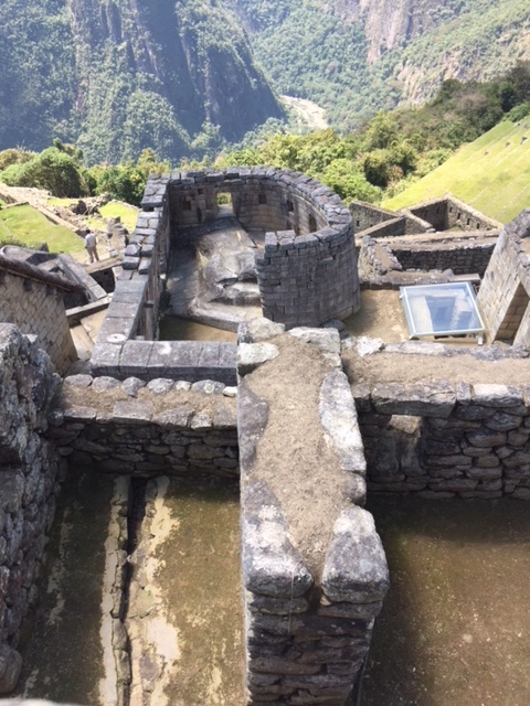
Sun Temple at Machu Picchu, looking east to sunrise.
We woke early to catch the sun rising above the eastern peaks. Before the crowds, we hiked to the top of Wayna Picchu Mountain (sometimes named “Huayna Picchu,” the young mountain) with the palace, guardhouse, sundial, and glory of Machu Picchu below. We climbed very steep, narrow stairs (with only a few cables to grab to help our footing) to the top. The site was covered with jungle plants and vines, a few orchids still in bloom, some strawberry plants growing between the rocks, and exquisite views. We were surrounded by two mountain ranges with peaks over 18,000’.
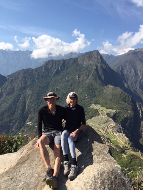
Here we are at top of Wayna Picchu (the young mountain) with Machu Picchu in background.
We walked to the Sun Gate, the formal entrance to Machu Picchu and the road into Machu Picchu for those who hike the original Inca Trail. The expansive view of Machu Picchu surrounded by layers of mountain ranges must have been the dream of his lifetime for Hiram Bingham, who “discovered” Machu Picchu in 1911-1912, even though it was mostly covered by jungle at that time.

Looking back to Machu Picchu from Sun Gate, the main entry.
Doug and I took the opportunity to walk to the Inca Bridge, by way of a very narrow trail (with a sheer edge). The trail was a back way used by Inca runners, perhaps messengers, to get to the site quickly.
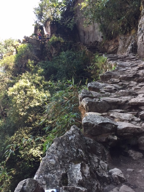
Trail to Inca Bridge with sheer drop-off to perhaps 1,000′ below.
The Inca Bridge trail ended just before the actual wooden bridge; we could see once again the nearly-impossible building of trails and passageways and the fearlessness of the workers. My stomach lunged thinking about walking the bridge let alone figuring out how it was built!

An engineering feat, the Inca Bridge is now closed!

Looking toward Machu Picchu high gate above terraces, a reminder of the size of this palace.
And then, our trip in the Andes was completed and we headed to the Amazon River Basin for a few days.
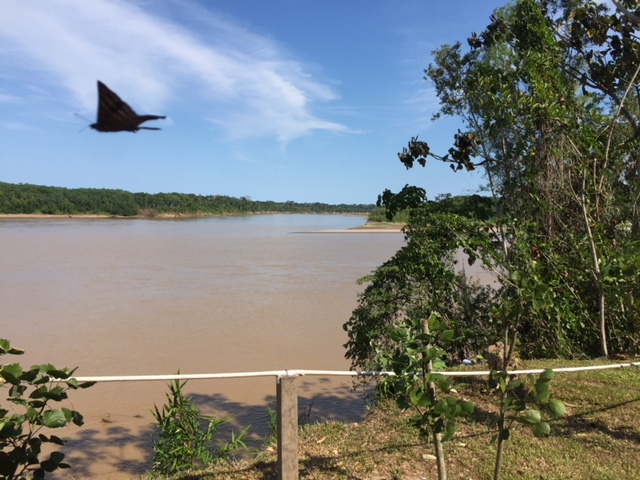
Madre de Rios, at Amazon River Basin, from our open air cabana.
Day light rose abruptly in the jungle above the muddy waters of Madre de Dios, at the start of the Amazon river basin in Peru. The conservation lodge where we stayed sets between the edge of the river and the rain forest. Our guide to Lake Sandoval, where we saw caiman (crocodiles), lake otters, tens of types of birds; the tree canopy walk (where we walked on suspension bridges high above the trees); a trek through the wetlands where anaconda live (fortunately we didn’t encounter any); and a night walk to see insects, fireflies and the amazing sky (with no ambient light the Milky Way was exquisite) was excellent. The jungle guides require two years of schooling along with ongoing training…although our guide said he learned most from his father! Impossible to capture the feeling of the dense jungle, the huge plants, the constant sounds of birds, howling monkeys, and bugs!

Lake Sandoval where we rode flat-bottomed canoe and saw caiman, lake otter, heron, five foot tall termite piles, and lots of birds (of which I can name almost none).
We climbed a wooden tower (98’ above the jungle floor) to canopy walk over the rain forest at Amazon River Basin. Suspension bridges felt precarious but the perspective on the huge palms, fichus trees, hanging vines and forest layers was unique. So much to learn whilst enjoying this spectacular place.
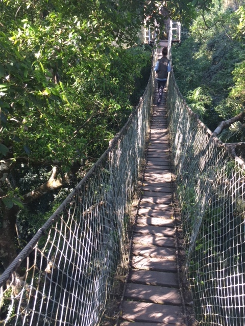
Canopy walk 100′ above jungle floor at Amazon River Basin.
We went on a rain forest night walk and saw Walking Stick insects as well as mother Tarantula with baby, Army ants carrying loads twenty times their weight, fireflies, Praying Mantis, and other exotic bugs!

While we visited only a tiny part of Peru, the Andes and the Amazon River during our most recent adventure, we will savor incredible, priceless memories for years to come.
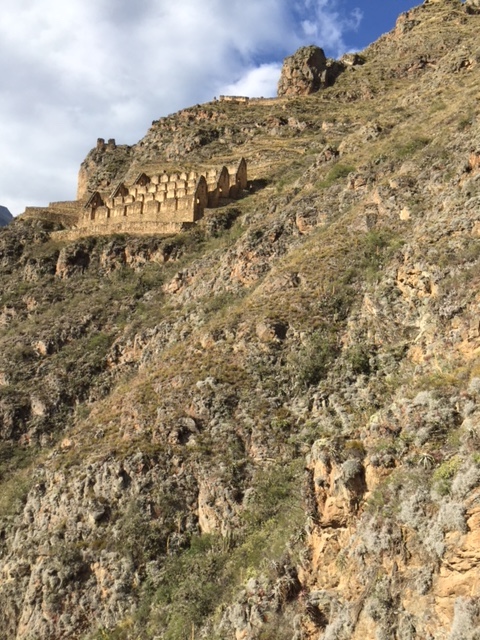
Storage houses above Ollanyantambo. We hiked up a precarious trail to reach them; not for the weak of heart!